The Climate Toolbox
A collection of web tools for visualizing past and projected climate and hydrology of the contiguous United States.
Applications


Tools

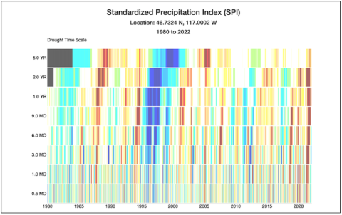
Historical Drought Stripes
Stripes of past short and long term droughts as a timeseries for a location
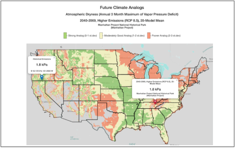
Future Climate Analogs
Maps of future and historical climate analogs for locations in US National Parks
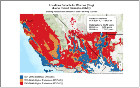
Future Crop Suitability
Map of future crop suitability, phenology and irrigation projections for a location